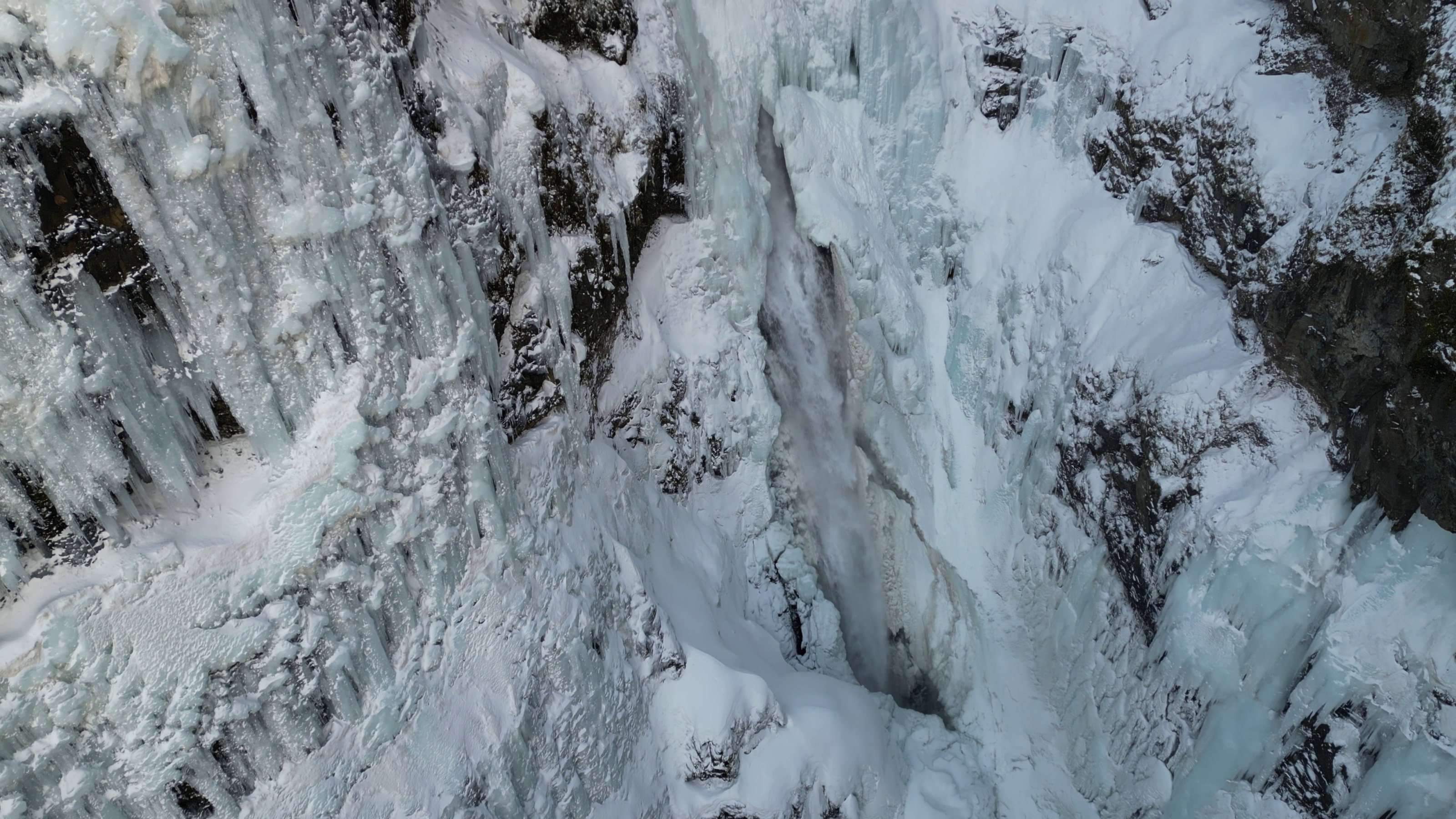
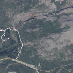
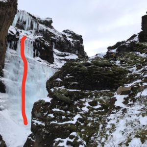
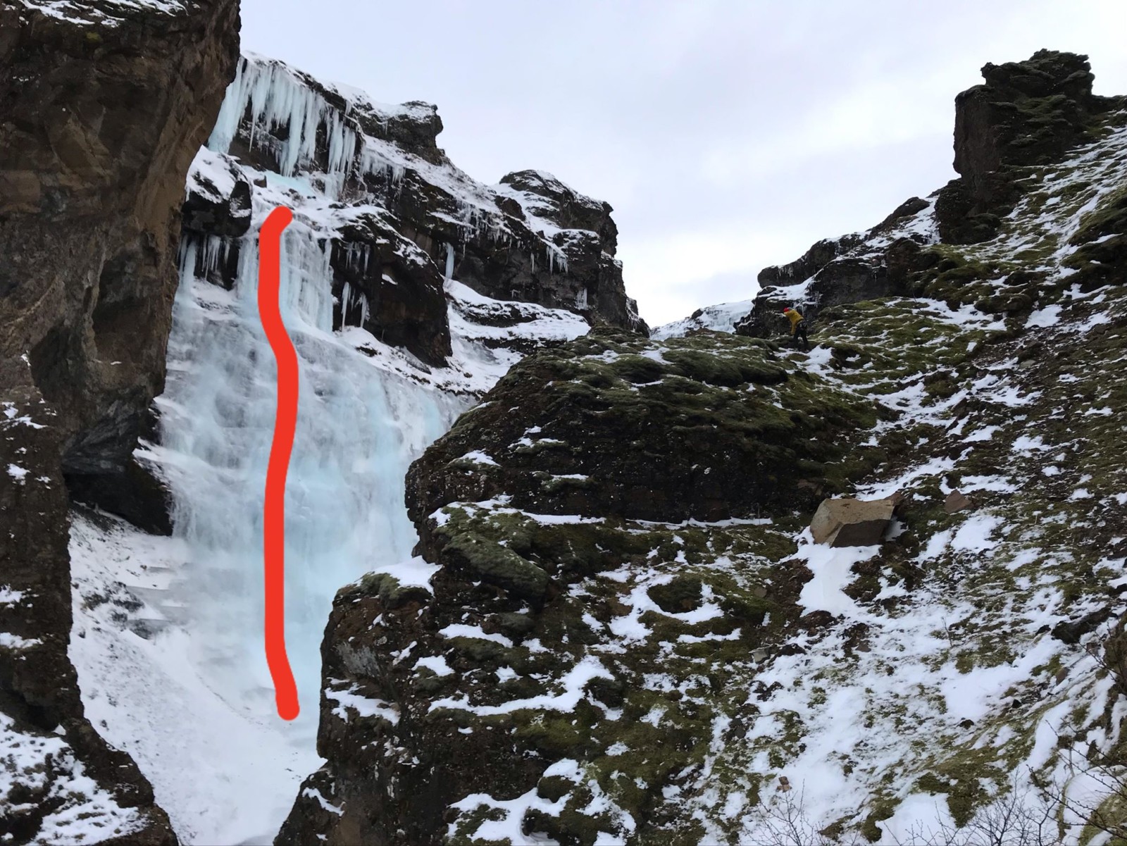
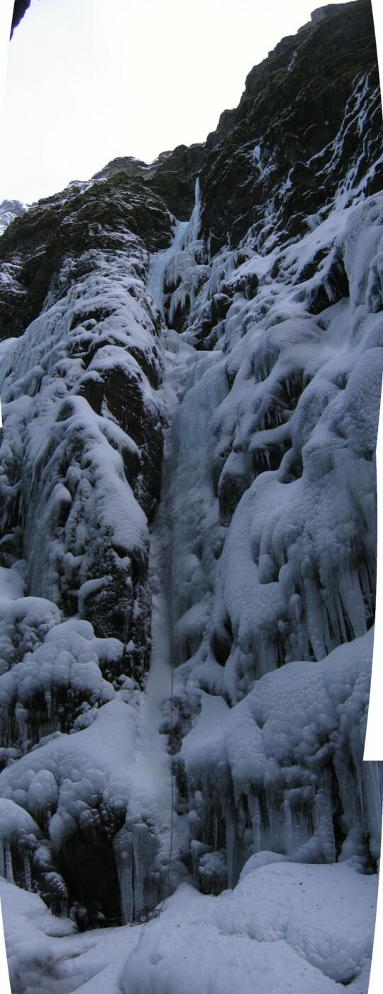
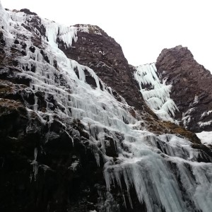
Winter 2023 was unusually cold; it was the coldest winter in southwest Iceland for a hundred years. This created unique conditions in the canyon below Glymur and for the waterfall itself. On January 17th that year, an Icelander living in Italy and an Italian living in Iceland ventured into the canyon with a mission to climb any of the established sought-after routes in this magnificent setting. However, due to the unique conditions and the old pencil-drawn topos on isalp.is being extremely confusing, they ended up climbing a new route. During the climb they thought they might be on Sacrifice (WI5+) or a variation of Draumaleiðin (WI5+) but it turned out to be neither.
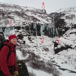
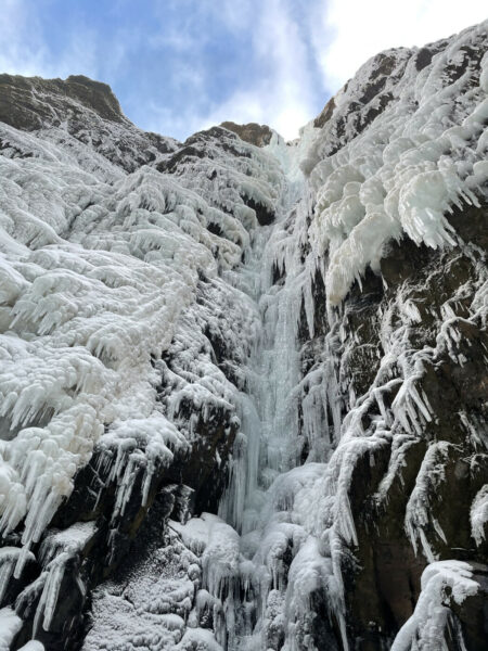
It became apparent that this section of Glymur hadn’t been climbed before. Watching old videos and pictures the reason was also apparent – that section was never frozen. Instead, it was a booming waterfall with ice on both sides. Sacrifice is to the left of this flow while Draumaleiðin is on the right side, and even further right – since it goes up the canyon wall on the right and climbers will top out on the south side of the canyon.
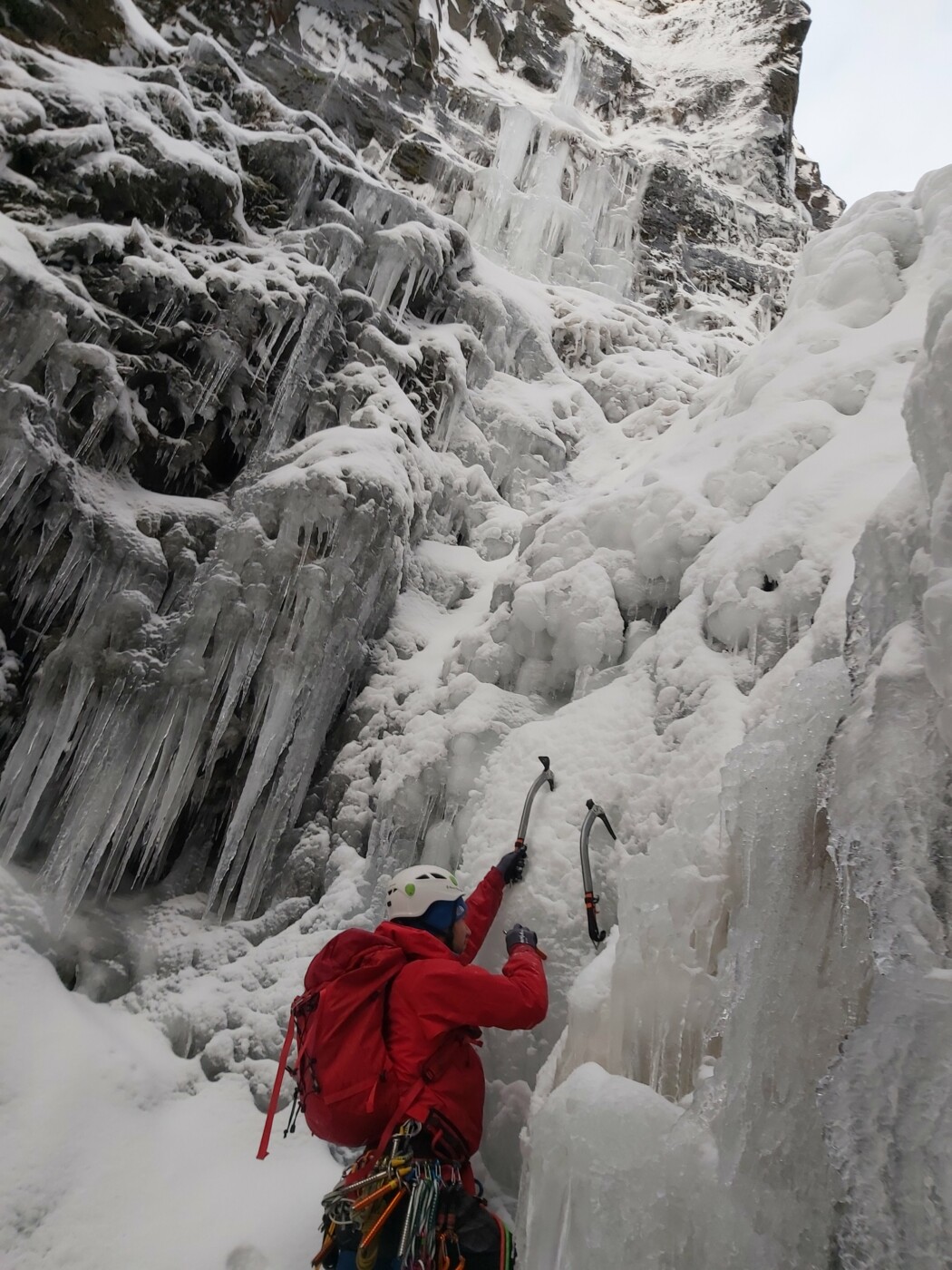
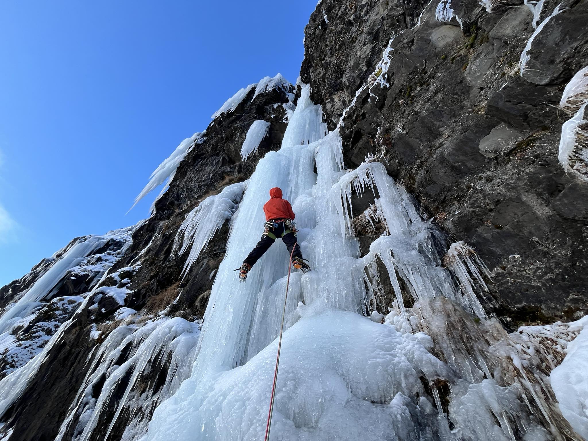
For the first half the new route goes up towards the jaws of Glymur – where the flow is strongest. This part contained a full pitch of overhanging cauliflower ice formations with tricky protection. It was full commitment climbing requiring ice climbing in all three dimensions. In keeping with the mouth analogy the ice formations resembled the crooked teeth of an enormous giant. For the second half the waterfall was still partially open so the route veers to the right of the main flow to avoid the spray. In Icelandic the name is “Gin Glyms”, since gin means open mouth in Icelandic and alliteration is cherished by the natives. Gin & tonic may also have played a part in the naming.
Route description
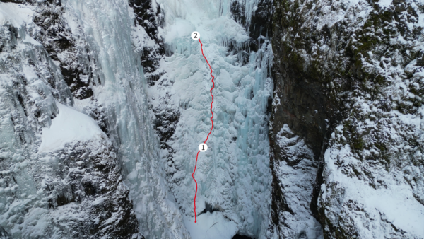
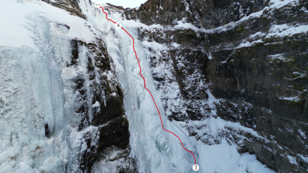
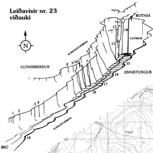
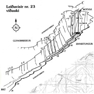
The route is between Sacrifice and Draumaleiðin. Those routes are identified as number 14.1 and 14.5 respectively on isalp.com. Based on that numbering scheme Gin Glyms should be around 14.2 – since it starts closer to the former than the latter. The route is long (over 200 meters) and here is an attempt at a video topo of the route, but traditional text and pictures are provided below.
Pitch 1 (35m WI4+): The first pitch goes mostly straight up – on near vertical ice lacking features. The ice was tough and the anchor was chosen at the first possible rest, right before the cauliflower ice formations became prevalent. In the beginning of the pitch a large bergschrund had to be crossed
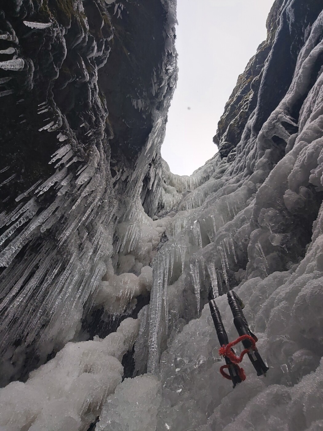
Í
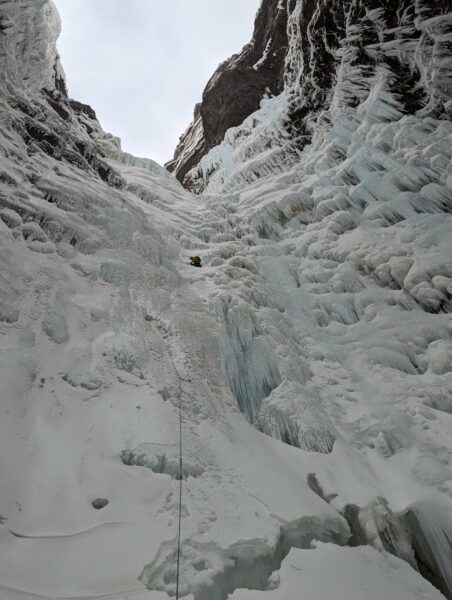
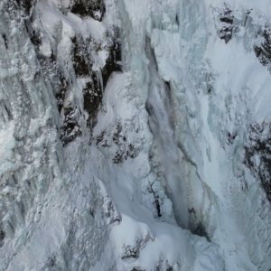
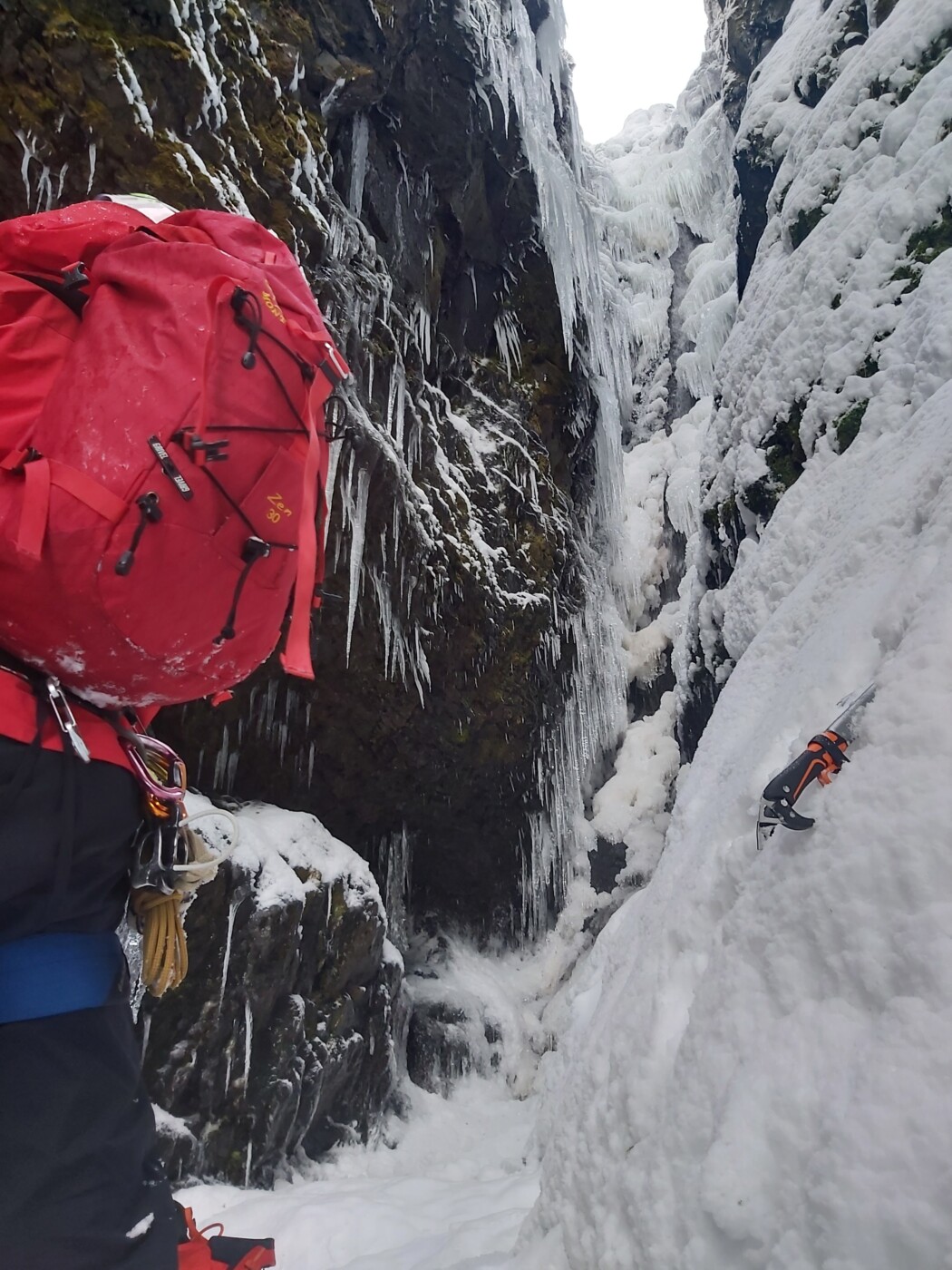
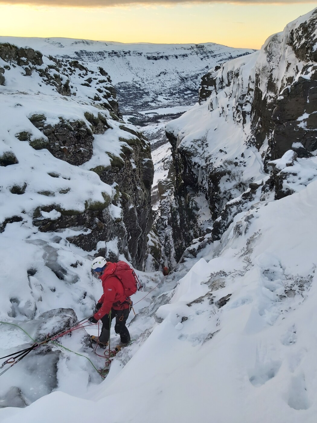
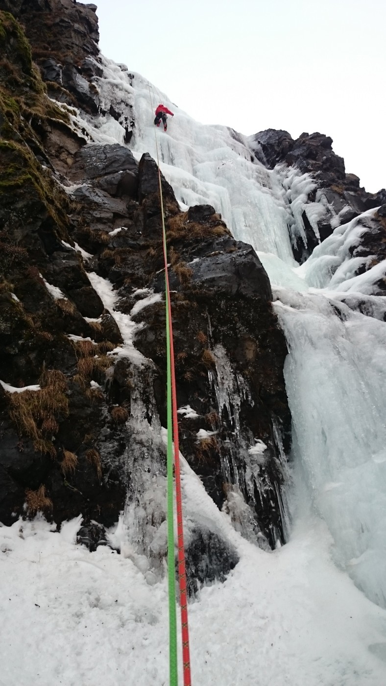
Matteo builds an anchor after the first pitch. The bergschrund-like crevasse can be seen at the bottom of the picture.Pitch 2 (55m WI5): Start by traversing right from the anchor by about 5 meters. This puts your belayer out of the fall line and puts the climber directly on the cauliflower adventure path. This section was tricky because the consistency of the ice varied. The roofs and icicles required delicate technique that was closer to bouldering than the regular steep ice routine. Navigation was also a challenge; it was sometimes impossible to see what lay ahead while hanging under a roof. Fortunately, communication with the belayer was possible and could be counted on for general directions. The pitch ends by a large ice wall, at the bottom of the open waterfall, where it provides shelter for spray and falling ice.
Pitches 1 and 2. Pitch 2 ends by an ice wall that provides shelter from the open waterfall above.
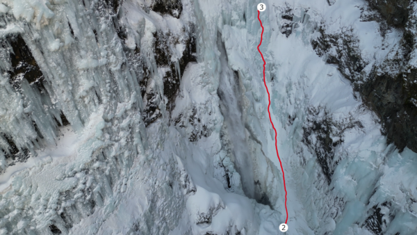
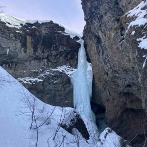
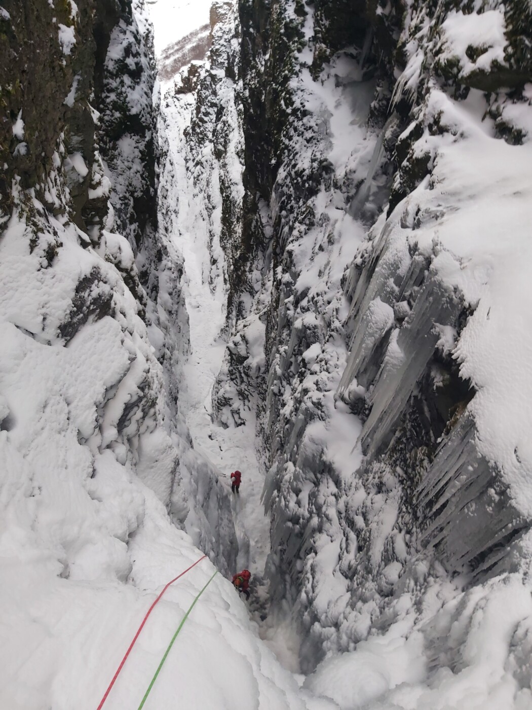
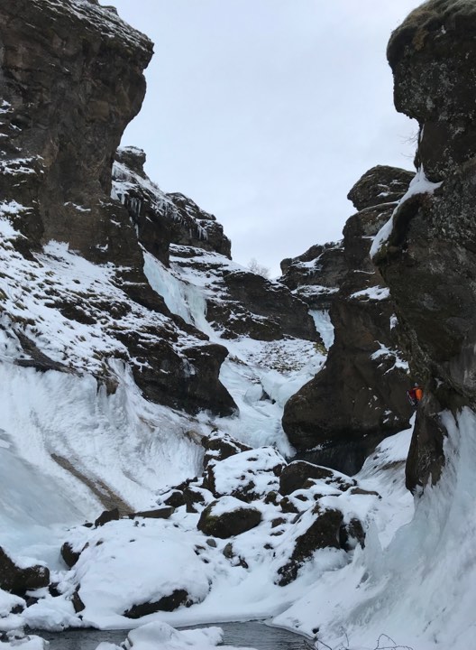
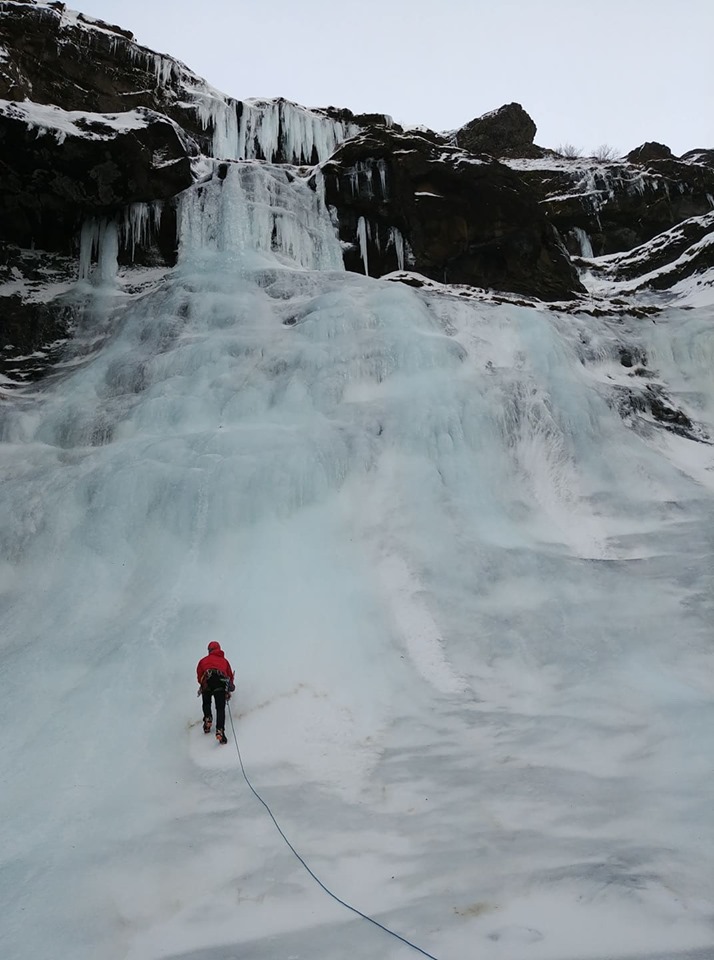
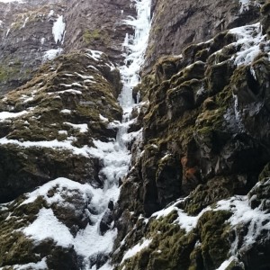
Pitch 3 (75m WI4+): This pitch starts as a low-angle ice walk across a channel that takes you to the right of the open waterfall. It is possible to protect on the right side and we placed one screw there, about mid way. It was most important for the climber to get quickly across since on this section ice mist is coming down and there is no shelter from falling ice. Once on the “other side” there is plenty of ice for screws. We estimate that the “ice walk” is about 15-20 meters long, the rest was regular steep waterfall ice climbing. We extended our 60 meter rope to cover the 75 meters by using a running belay at the end.
Pitch 3. The camera is tilted downwards and the waterfall can be seen to the left of the route. The route was climbed a few days earlier and had a bit more ice and less snow than this picture shows.
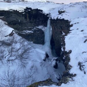
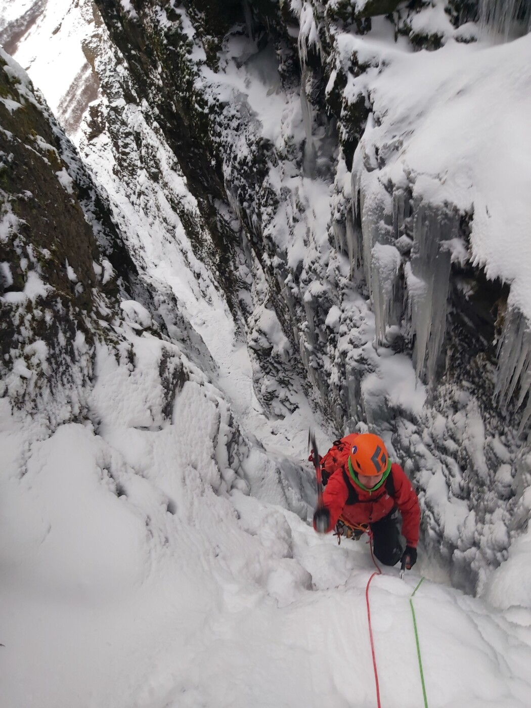
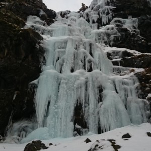
Pitch 4 (60m WI4+): Starts with a steep but short ice section. It then turns into very delicate climbing, due to the snow covering the ice. The angle isn’t vertical so it’s possible to lean into the snow but careful movement is required in order to not start sliding and finding placements requires searching, sometimes on rather long runouts. In hindsight, better ice could have been had by traversing left but this would also put climbers closer to the booming waterfall which comes with another set of risks. We ran the rope out on this one and found a good spot for belay. This however forced us to climb a short extra pitch to top out on Botnsá.
Pitch 4.1 (10m WI3): This pitch felt very easy after everything else we had done, also very short. Not much to say about it. Going into it, we didn’t know how much we had left, because we couldn’t see the top from our anchor at the end of Pitch 4.
Pitches 4 og 4.1. The final pitches on the route.
FA Halldór Fannar and Matteo Meucci, January 17th, 2023
Winter 2023 was unusually cold; it was the coldest winter in southwest Iceland for a hundred years. This created unique conditions in the canyon below Glymur and for the waterfall itself. On January 17th that year, an Icelander living in Italy and an Italian living in Iceland ventured into the canyon with a mission to climb any of the established sought-after routes in this magnificent setting. However, due to the unique conditions and the old pencil-drawn topos on isalp.is being extremely confusing, they ended up climbing a new route. During the climb they thought they might be on Sacrifice (WI5+) or a variation of Draumaleiðin (WI5+) but it turned out to be neither.
It became apparent that this section of Glymur hadn’t been climbed before. Watching old videos and pictures the reason was also apparent – that section was never frozen. Instead, it was a booming waterfall with ice on both sides. Sacrifice is to the left of this flow while Draumaleiðin is on the right side, and even further right – since it goes up the canyon wall on the right and climbers will top out on the south side of the canyon.
For the first half the new route goes up towards the jaws of Glymur – where the flow is strongest. This part contained a full pitch of overhanging cauliflower ice formations with tricky protection. It was full commitment climbing requiring ice climbing in all three dimensions. In keeping with the mouth analogy the ice formations resembled the crooked teeth of an enormous giant. For the second half the waterfall was still partially open so the route veers to the right of the main flow to avoid the spray. In Icelandic the name is “Gin Glyms”, since gin means open mouth in Icelandic and alliteration is cherished by the natives. Gin & tonic may also have played a part in the naming.
Approach: park the car by Glymur park and walk back to the gate of the summerhouses 100m before. Walk the road and take the right brach. next to the houses there are 2 option: or follow the canyon up to the waterfall or go on the left and then by the place, lower on the slope towards the route. If you stay on the right of the canyon going up then you need to go over the route, find a place to cross the stream and then lower and by the slope get into the canyon.
The top part of the route is visible from the road, so easy to check if in condition or not.
FA: Matteo Meucci and Kasper Solveigarson 16/01/2023 WI4 25m
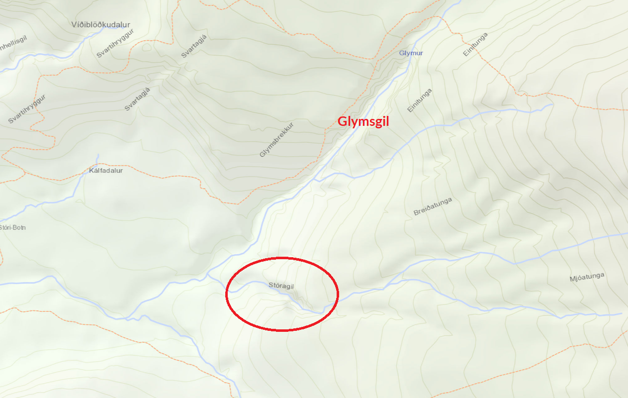
Route in the bottom of Svartagjá in Botnsdal, close to Glymsgil
Excellent route which deserves more visits.
The route starts with a short step, WI3, which leads into the canyon. Walk up the rocky canyon takes you to a 60 meter tall waterfall, WI4. The route can be climbed in two 30 meter pitches with a nice belay in a small cave on the right.
Pictures from an attempt of the route can be found here.
Leið í áberandi gili rétt áður en komið er í sjálft Glymsgilið.
Þegar gengið er eftir gönguleiðinni upp að glym er farið í gegnum helli sem heitir Þvottahellir. Þegar staðið er uppi á brún áður en farið er niður og í gegnum hellinn þá er Stóragil þar beint á móti.
Leiðin byrjar aflíðandi en verður brattari eftir því sem ofar dregur. Fyrir ofan leiðina er bratt kerti sem er ófarið eins og er.
FF: Gunnar Ingi Stefánsson og Illugi Örvar Sólveigarson, desember 2019
Leiðin er fyrir neðan Hvalina þrjá og byrjar fyrir neðan stóru steinana og þrenginguna í gilinu. Séð úr gilinu virðist vera ,,slabb” í leiðinni og er nafnið dregið af því. Leiðin byrjar í sléttum vegg með þunnum ís, ca. 25 m. Þaðan er haldið yfir slabbið að þunnum kertum og flóknum. Leiðin endar í 10m klettum.
FF: Jón Haukur Steingrímsson og Guðmundur Tómasson, 1997, ríflega 2 spannir, WI 4/5
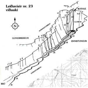
Þeir sigu niður Þrym og klifruðu upp nýja leið fyrir neðan, þ.e. vinstra megin við Þrym sem er nr. 11 í leiðarvísi nr 23. – viðauka. Nýja leiðin, sem þeir nefndu Hlyn, er þriggja spanna og fyrstu tvær voru nokkuð brattar með miklum snjó en sú síðasta var mjög brött með miklu íshröngli. Ekki var hægt að komast beina leið upp á brún vegna þess að ísinn náði ekki niður og klettarnir eru slúttandi síðustu 20 metrana.
FF: Guðmundur Helgi, Páll Sveinsson og Þorvaldur Þórsson, 1. mars 1998, 130m
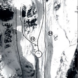
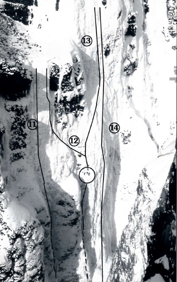
Leið ekki merkt inn á mynd, hægra megin við leið númer 14
Nýtt afbrigði af Glym. Leiðin er alveg innst inni í kvosinni rétt vinstra megin við Glym sjálfan. Þetta voru rúmlega fjórar spannir og er WI 5+ að sögn Christophe Moulin. Leiðin hlaut nafnið Sacrifice vegna þess að Manu missti af sér hjálminn í annari spönn og öxi eins klifrara sem stóð á brúninni endaði einnig i gilbotninum.
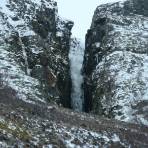
Leið skammt fyrir neðan leið númer 19, sem sag ein af stuttu ísfossunum
Leiðin er í þröngu gili. Leiðin byrjar á stuttu íshafti 6 -7 m og þaðan upp flata inn að öðru 30m hafti.
FF: Ívar Finnbogason og Rúnar Óli Karlsson, 19. janúar, 30m
180-200 m. 4 spannir.
Neðsta leiðin i aðalveggnum. Hún hefst á íslausu eða íslitlu hafti sem er um 15 m 6 hæð. Þaðan er snjóbrekka yfir að fríhangandi kerti neðst í 50 m háum ísfossi.
FF: Dagur Halldórsson og Viðar Þór Hauksson, 24.feb.1995.
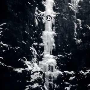
Leið númer 17, myndin er af efri hluta leiðarinnar
100 m. 2-3 spannir
Leiðin byrjar í 20 m langri snjóbrekku sem leiðir að 5m háu klettahafti með þaki. þaðan
er önnur 20 m snjóbrekka að 60 m háum lóðréttum
ískafla. Leiðin endar eins og leið nr 15. (Ísalp leiðin)
FF: Hallgrímur Magnússon og Páll Sveinsson, 19. feb.1995.
100 m. 3 spannir
Leiðin byrjar í greinilegu ísmiklu hafti, þá tekur við snjóbrekka sem liggur upp að klettabelti, um 15 m háu, og þaðan eru 50 m í þunnum ís að 10 m háu kerti. Leiðin endar eins og leið nr 15. (Ísalp leiðin)
FF: Dagur Halldórsson og Viðar Þór Hauksson 19. feb.1995.
100 m. 2-3 spannir
Ísstallar með lóðréttum höftum. Þegar leiðinni er lokid Þarf að hliðra eftir syllu í miðjum klettaveggnum. Þessi hliðrun er varasöm og leiðin því ekki ráðleg byrjendum.
FF: Árni Eðvaldsson, Ólafur V. Birgisson og Þorvaldur Þórsson, 4. mars.1995.
Leiðin hefur bara verið klifin einu sinni og þá var sigið inn í gilið ofan frá. Leiðin er í hægri hluta Glyms og yrði þá leið 14,5 í númeraröðinni. 200m
Leiðin byrjar á tveimur auðveldum 4. gráðum og síðan tekur við stutt lóðrétt haft upp til hægri á sillu sem er undir þaki. Þarna verður að hliðra til vinstri heila spönn til að komast framhjá þakinu. Síðan tekur við létt brölt upp skoru upp á næstu sillu fyrir ofan og hliðrað síðan aftur til hægri undir næstu spönn. Næsta spönn er um 50m lóðrétt (á köflum aðeins yfirhangandi) og vantaði um 3m í að ísinn næði saman um 1/3 af leiðinni upp haftið. Þarna er hægt að nota bergtryggingar. Þetta íshaft er lang erfiðasti partur leiðarinnar. Þar fyrir ofan tekur við létt snjóbrölt og hliðrun til hægri framhjá hengjum á brúninni. Leiðin endar við áberandi stein(eða klett) sem er þarna frammi á stapa þar sem stoppað er mjög oft til að skoða fossinn.
Leiðin er upp suðurbarm Glymsgils og er nokkurnvegin beint á móti leið sem kallast Hlynur.
Umsögn um frumferðina á þessari leið má finna í Ísalp ársriti frá árinu 2000
FF. Páll Sveinsson og Þorvaldur V. Þórsson, 10. mar. 1999
Leiðin liggur næst Glym upp eftir veggnum, hægra megin við leiðir 12 og 13. Fyrsta spönniner tortryggð vegna úðans frá fossinum. Fyrstu tvær spannirnar eru mjög brattar, við af þeim tekur stutt WI 3 spönn undir lokaveggnum.
FF: Hallgrimur Magnússon, Hörður Magnússon
og Tomas Grønvaldt.
Fyrstu tvær spannirnar eru þær sömu og í leið 12. Þaðan er hliðrað upp til hægri og fossinn klifinn á enda. Þriðja spönninn er af 3. gráðu og við af henni tekur lokaveggurinn rúmir 40 metrar.
FF: Dagur Halldórsson og Karl Ingólfsson, 11. feb. 1995.
Leiðin liggur lengst til vinstri í Glymshvelfingunni. Eftir tvær spannir er hliðrað til vinstri yfir Þrym og leiðin kláruð hægra megin í þeirri rennu. Fyrsta spönnin er klifruð innst í kverk og í annarri spönn er farið hægra megin við kverkina upp í stans. Í þriðju spönn er svo hliðrað til vinstri undir lóðrétt kerti.
FF: Magnús Gunnarsson, Páll Sveinsson og Þorvaldur Þórsson, 13. Mars 1994.
Bein lína innst í gilinu við hlið Glyms. Klifrað er upp kverk fyrstu tvær spannirnar þar sem leiðin opnast og endar samhliða upprunalegu leið Glyms. Leiðin er mjög samfelld og með slæmum tryggingastöðum.
FF: Guðmundur Tómasson og Jón Haukur Steingrímsson, 24. feb. 1995.
Leiðin er innst í röð þessara þriggja fossa. Leiðin byrjar á bröttu íshafti ca. 10 m. Við af því tekur snjóbrekka undir 50 m frístandandi ískerti. Leiðin endar á syllu hægra megin við Svala. Liggur beinast við að klára leiðina upp SVala eða Þorsta. Einnig er hægt að hliðra eftir syllunni til vinstri og ljúka leiðinni þannig.
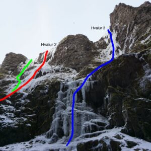
Erfiðasta Hvalurinn.
FF: Hallgrímur Magnússon og Páll Sveinsson, 15 feb. 1995.
Leiðin liggur upp efitr stuttum íshöftum og bröttum ísbrekkum fyrstu 70 m. í lokin er bratt ískerti 25-30 m. Þar endar leiðin á syllu neðan við Svala. Það liggur beint við að klára leiðina upp Svala eð ljúka leiðinni með því að hliðra eftir syllunni til vinstri.
FF: Páll Sveinsson og Þorvaldur Þórsson, 18 feb. 1995.
Nokkur stutt höft eru fyrstu 50 metrana upp að 50 m háum mjög bröttum fossi. Leiðin liggur upp með kverk og það er klifrað innst í henni. Leiðin endar rétt vinstra megin við Þorsta.
FF: Dagur Halldórsson og Viðar Þór Hauksson, 17 feb. 1995.
Lóðrétt kerti þar sem endatrygging er í tré (NB eina leiðin svo vitað sé sunnan heiða). Aðkoma er auðveld hvort sem er ofan við fossana eða upp með gilinu.
FF. Björn Ólafsson og Þorvaldur Þórsson, 26. des. 1995.
Stuttir æfingafossar. Aðkoma er auðveld hvort sem er ofan við fossana eða upp gilbotninn.
FF: Ekki vitað
Comments
Vel gert. Hugsa að þetta sé fyrsta skipti sem klifrað er þarna rétt hægra megin við fossinn (spönn 3 og 4). Fyrri parturinn er á svipuðum slóðum og það sem ég hef túlkað sem leiðina Sacrifice, hef bara aldrei fengið almennilega staðfestingu á því hvar sú lína er. Ég, Matteo og Jonni klifruðum allavega svipaðan fyrripart (spönn 1 og 2) og þessi leið en kláruðum upp vinstra meginn við beljandi fossinn. Niðurstaðan þá var að skrá ekki nýja leið því mögulega væri þetta bara leiðin Sacrifice. Umræða um þetta skapaðist á facebook https://www.facebook.com/photo/?fbid=10156978120927264&set=a.10156944395367264


Vel gert. Hugsa að þetta sé fyrsta skipti sem klifrað er þarna rétt hægra megin við fossinn (spönn 3 og 4). Fyrri parturinn er á svipuðum slóðum og það sem ég hef túlkað sem leiðina Sacrifice, hef bara aldrei fengið almennilega staðfestingu á því hvar sú lína er. Ég, Matteo og Jonni klifruðum allavega svipaðan fyrripart (spönn 1 og 2) og þessi leið en kláruðum upp vinstra meginn við beljandi fossinn. Niðurstaðan þá var að skrá ekki nýja leið því mögulega væri þetta bara leiðin Sacrifice. Umræða um þetta skapaðist á facebook https://www.facebook.com/photo/?fbid=10156978120927264&set=a.10156944395367264